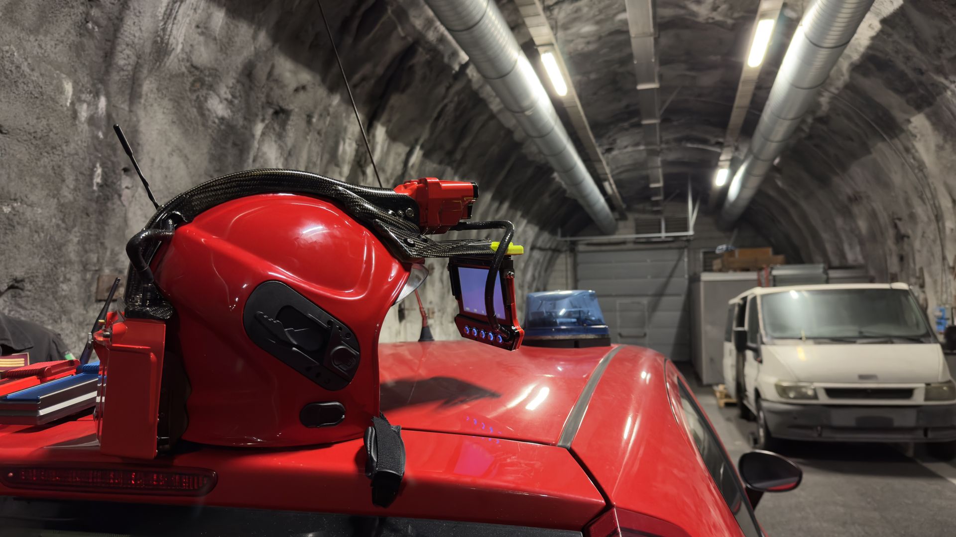
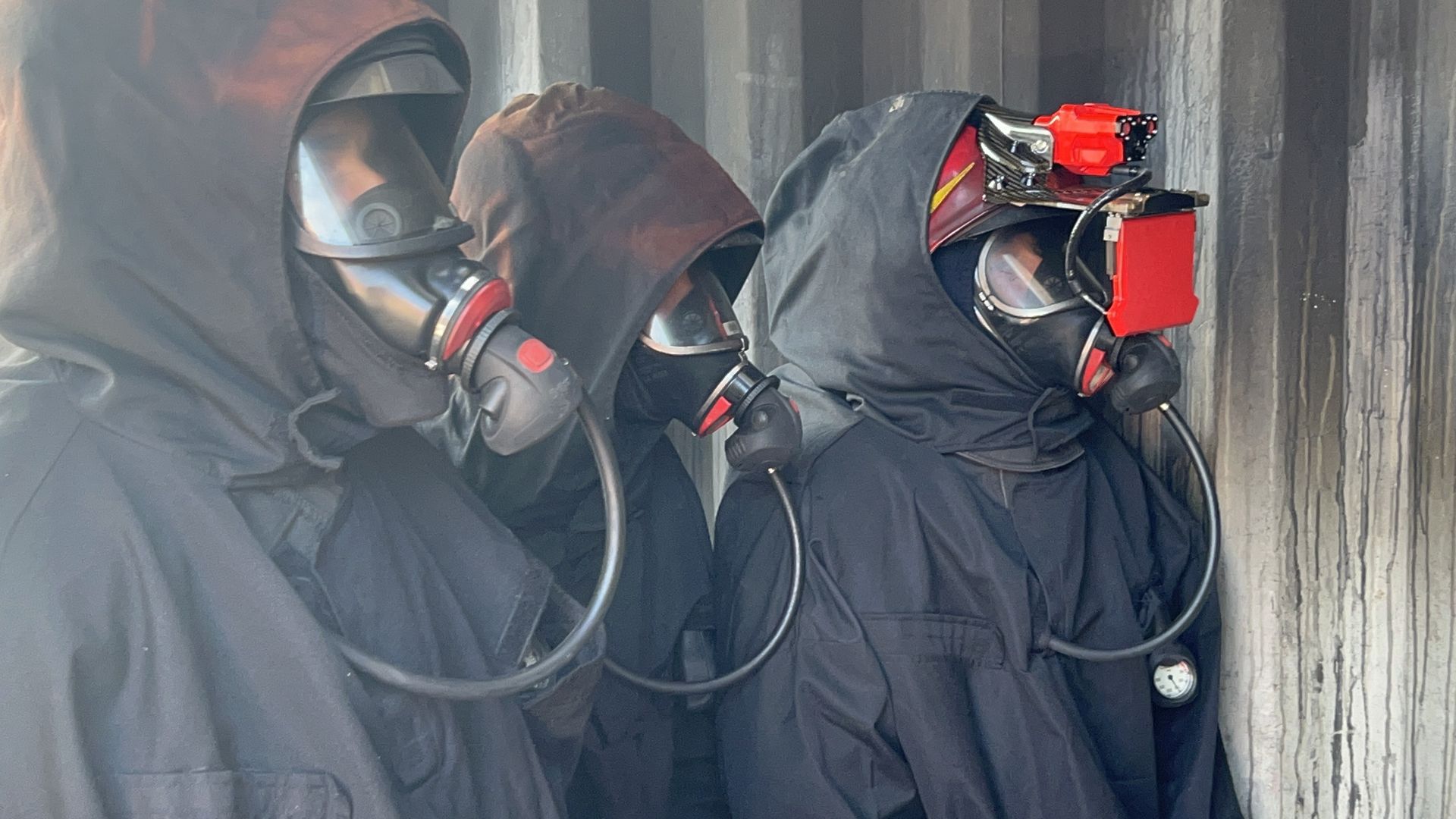
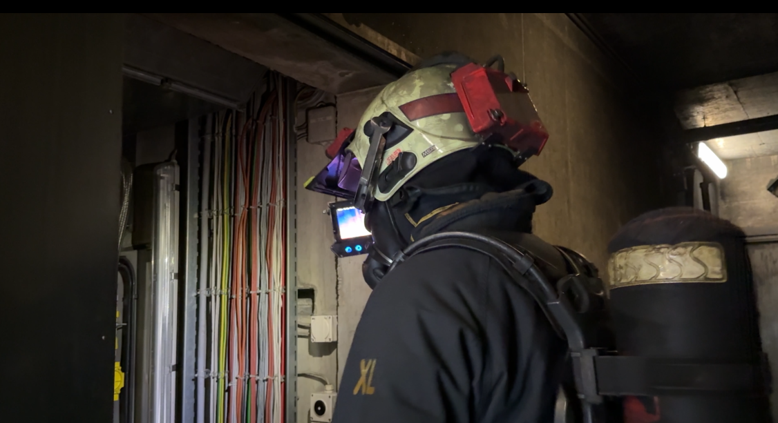
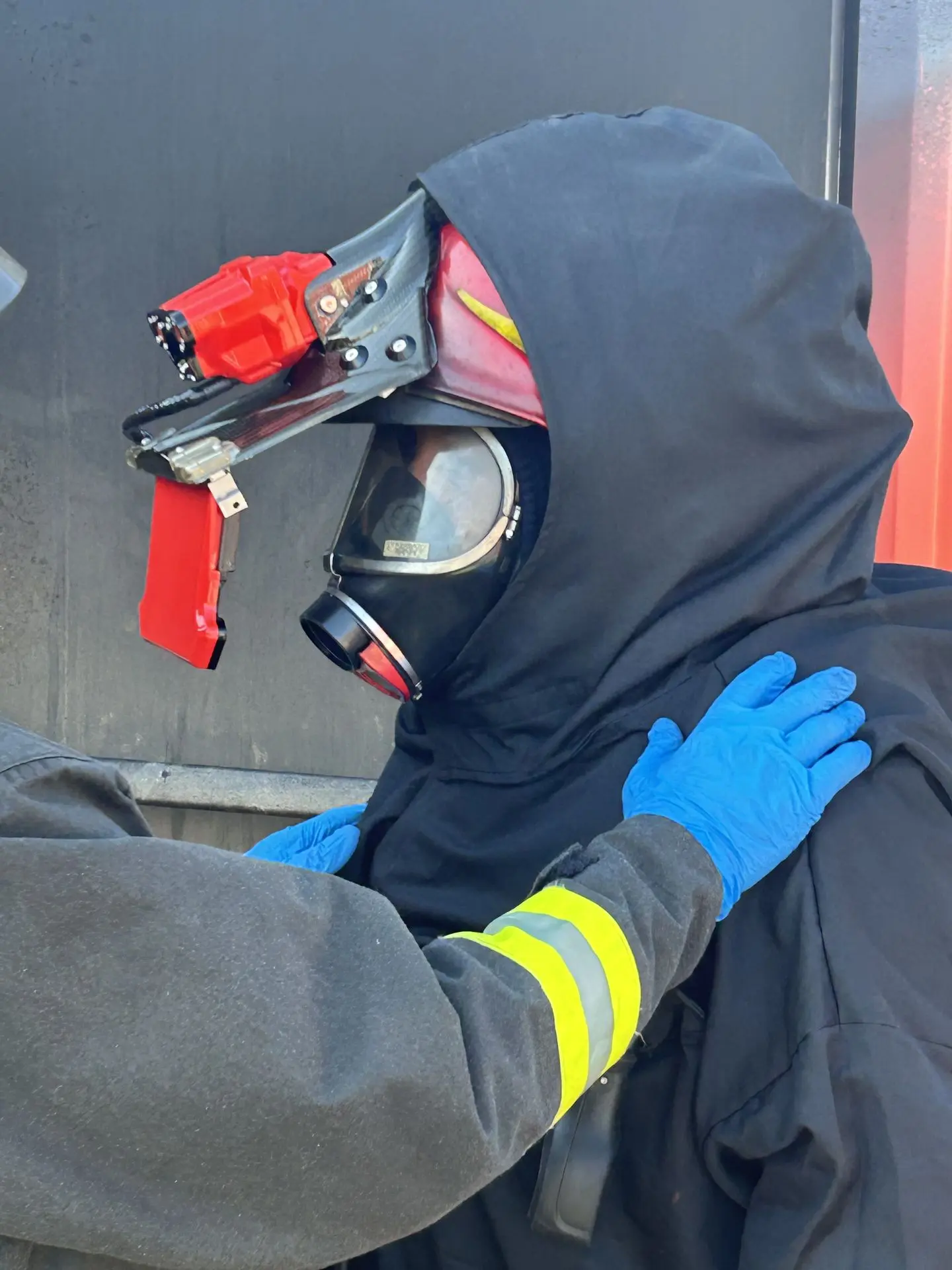
iFalconHM Applications
The iFalconHM helmet-mounted thermal camera system adapts to a wide range of critical situations, providing enhanced visibility and communication where they matter most. Its versatility makes it an essential tool for professionals operating in extreme and unpredictable environments.
Railway, highway
& tunnels Mine search
& rescue Riot management & containment High return facilities Wide areas coordination Long Range Night Vision
Mine search & rescueMine search & rescue
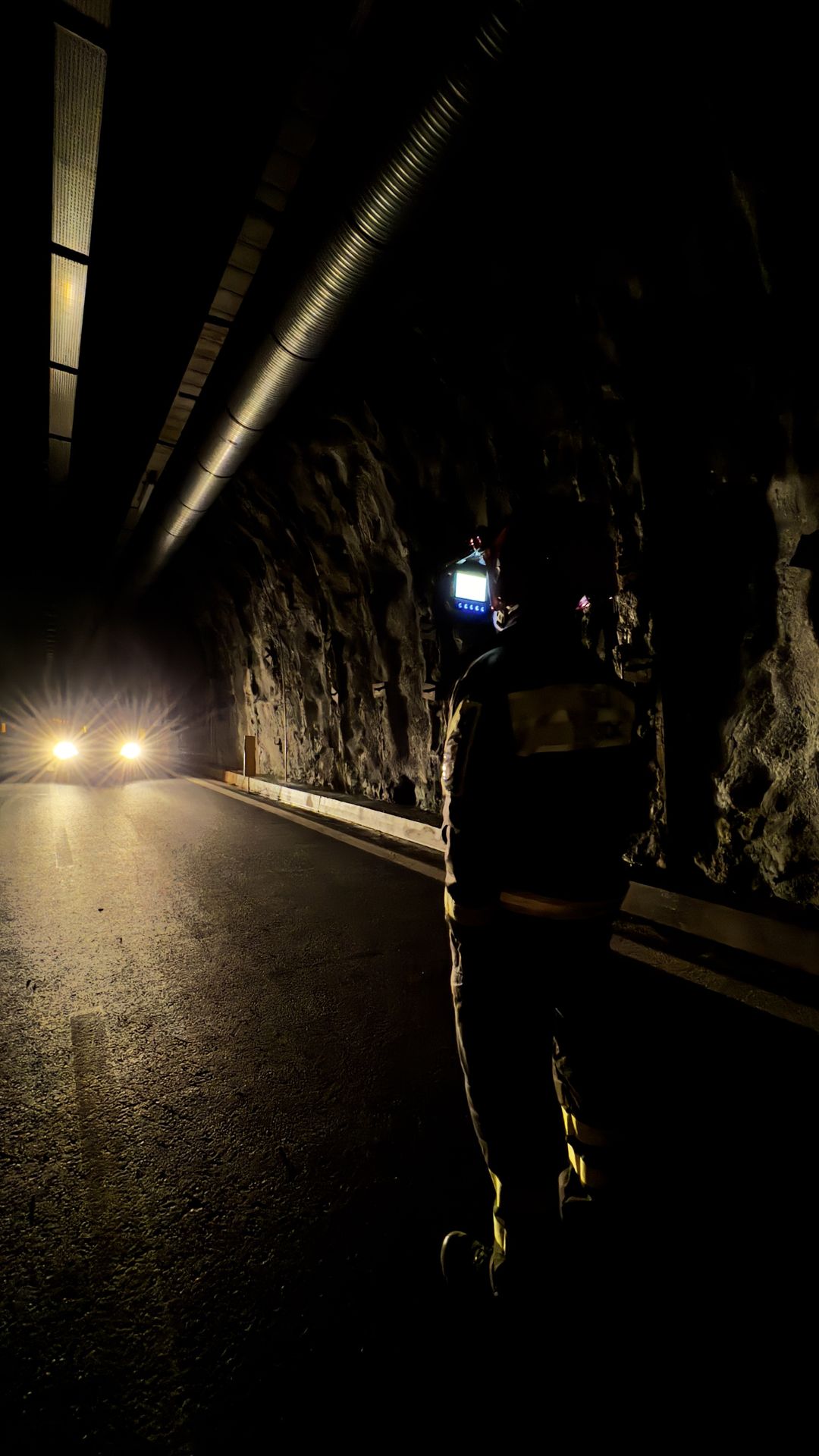
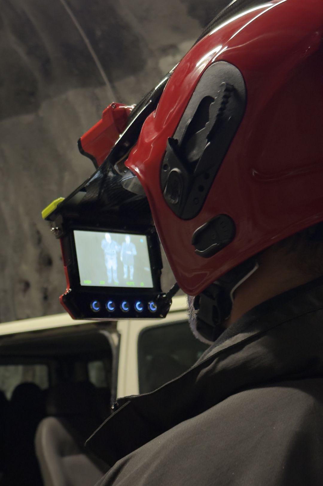
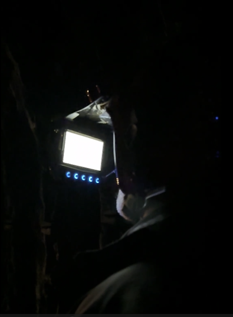
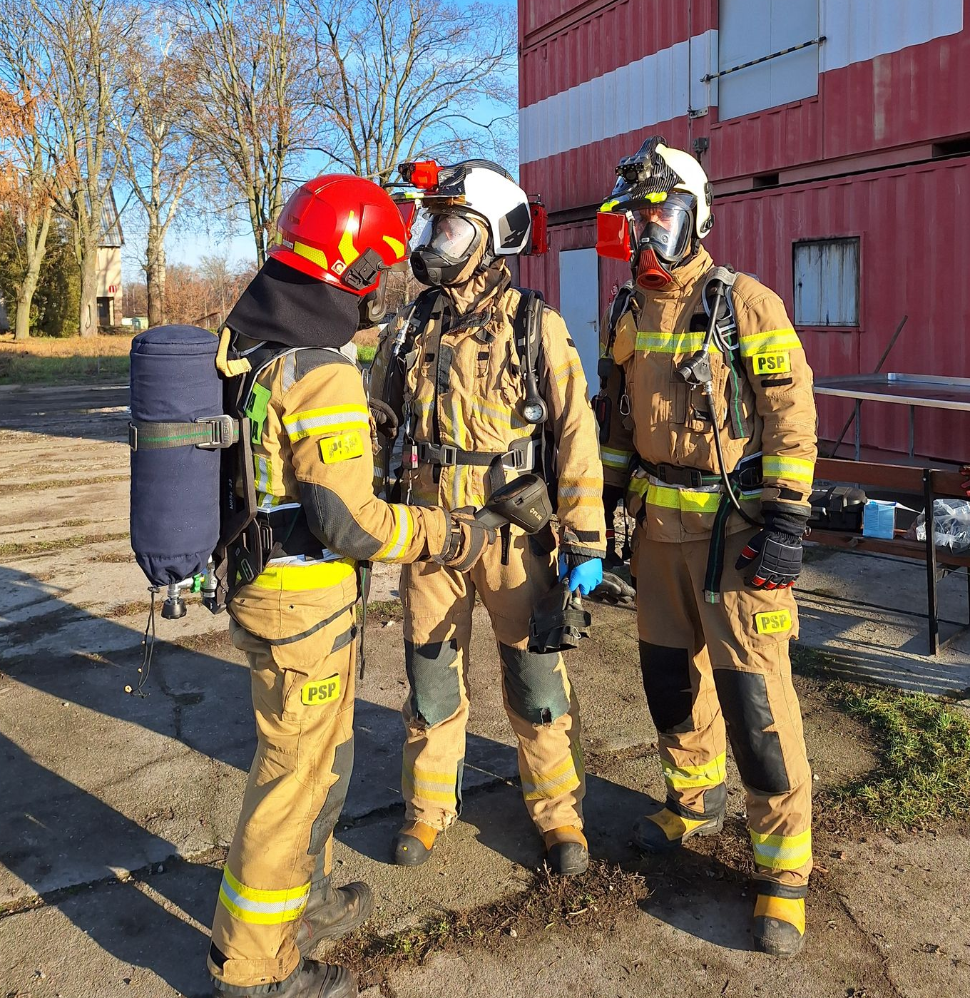
Firefighter and rescue team safety is a top priority in these hazardous environments. iFalconHM enables real-time tracking of team members, ensuring better coordination and safer operations. This is particularly crucial in tunnels, where exits may be far apart, and escape routes need to be carefully managed.
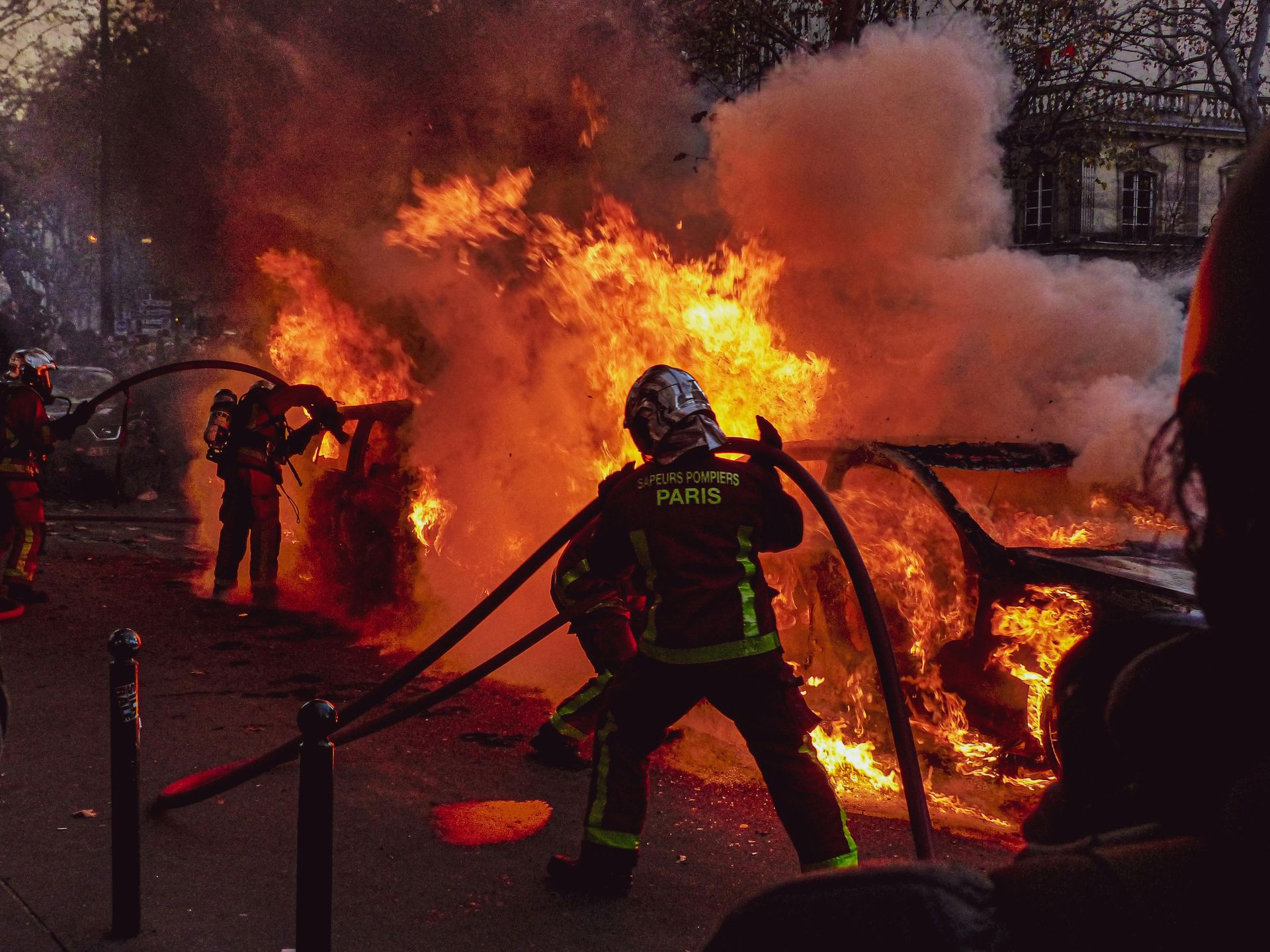
For infrastructure protection, thermal imaging helps detect hot spots early, allowing firefighters to contain fires before they cause severe damage to railway tracks, tunnel structures, or highway installations. This rapid response minimizes disruptions and prevents costly structural failures.
In tunnels and other enclosed spaces, wireless real-time video transmission is a game-changer. Command centers can monitor the incident remotely, providing firefighters with up-to-date information for better coordination and decision-making. This is especially useful in long tunnels or highway incidents where traditional communication may be compromised.
Navigating railway networks, highways, and tunnels during an emergency can be extremely challenging. iFalconHM improves visibility and orientation, helping responders move efficiently through complex or obstructed areas, reducing the risk of disorientation.
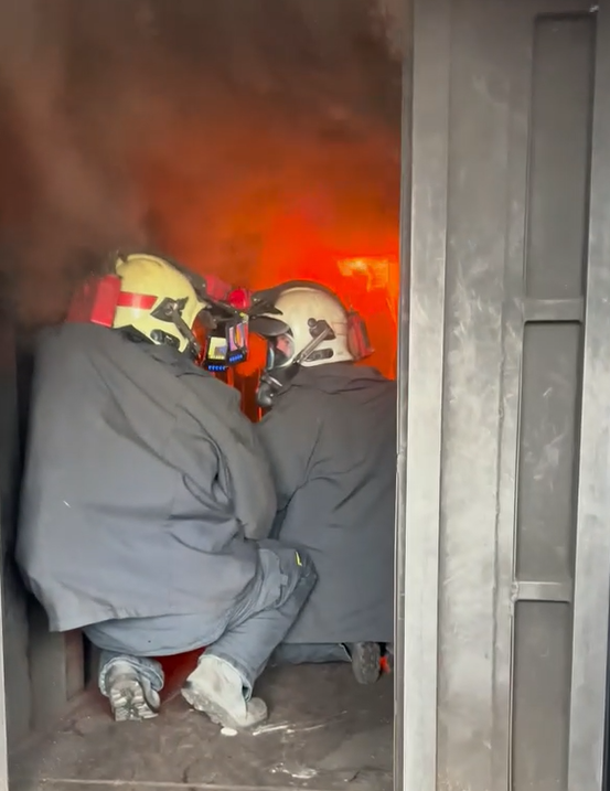
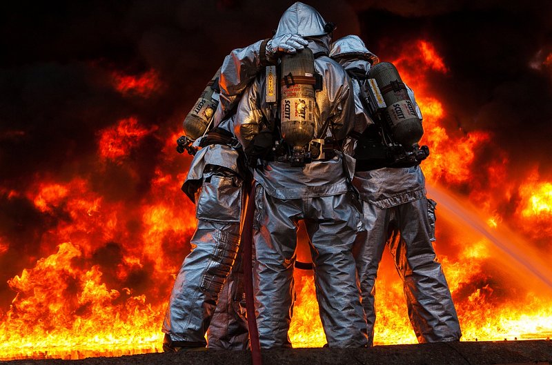
The iFalconHM system offers critical advantages in fire emergencies occurring on railways, highways, and tunnels, where visibility, communication, and rapid response are essential.
Fires in these environments often generate thick smoke and extreme heat, making navigation dangerous. iFalconHM’s thermal imaging allows firefighters and rescue teams to see through smoke, quickly identifying fire sources, trapped individuals, and structural hazards. This enhances situational awareness and speeds up rescue operations.
Railway, highway & tunnels
W miejscach, które są ciemne i trudno dostępne dla ekipy ratunkowej, nawigacja i rozpoznawanie otoczenia są utrudnione. Ratownicy pracujący pod ziemią mogą łatwo zlokalizować się nawzajem w słabo oświetlonym lub zapylonym otoczeniu.
Dzięki iFalconHM możliwe jest uratowanie jak największej liczby ofiar w bardzo trudnych i niebezpiecznych warunkach, w których szybkość działania ma kluczowe znaczenie. Ratownicy mogą komunikować się ze sobą, bez widzenia się nawzajem, dzięki sieci komunikacyjnej i łatwiej mogą dostrzec ofiary dzięki obrazowaniu termicznemu.
Mine search & rescue
Mine search and rescue is an incredibly challenging job. Locating and rescuing miners trapped deep underground in life-threatening situations necessitates specialized equipment. The conditions in which miners find themselves are often harsh, making conventional tools ineffective. Mines are typically dark, with narrow passageways that can be extremely difficult to navigate, particularly following incidents such as gas explosions, coal dust blasts, gas and rock outbursts, and underground fires.
iFalconHM is the ideal solution for life-threatening situations involving miners, where it is crucial to quickly locate casualties and provide rapid medical assistance.
Rescuers operating in tunnels or mines will have no trouble navigating through dimly lit or smoke-filled conditions while equipped with a self-contained breathing apparatus (SCBA). With iFalconHM, it becomes possible to maximize victim recovery efforts in these challenging and hazardous environments.
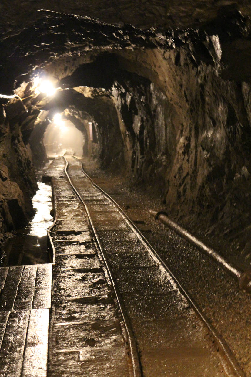
The iFalconHM system can play a vital role in mine search and rescue operations, where low visibility, hazardous environments, and communication challenges make rescues extremely difficult.
Mines are often filled with dust, smoke, and total darkness during emergencies, making it nearly impossible for rescuers to navigate. iFalconHM’s thermal imaging allows teams to see through these conditions, quickly identifying trapped miners, fire sources, or structural hazards. This improves rescue speed and efficiency.
One of the biggest challenges in underground rescues is communication. With wireless real-time video transmission, command centers can monitor the situation remotely, guiding teams through the mine with up-to-date information. This is essential in deep or complex mining tunnels where radio signals may not always be reliable.
Mines have intricate and extensive tunnel networks, which can be disorienting, especially in emergency conditions. iFalconHM helps rescuers navigate efficiently, reducing the risk of getting lost or trapped and allowing for more strategic deployment of resources.
Rescuer safety is a top priority in such hazardous environments. Real-time location tracking ensures better coordination, helping teams avoid dangerous areas while staying connected. This is crucial in collapsed or partially blocked tunnels, where movement needs to be carefully planned.
Early detection of hot spots or trapped individuals using thermal imaging helps responders prioritize rescue efforts, preventing further collapses or secondary hazards. By identifying dangers before they escalate, iFalconHM helps protect both victims and rescuers, increasing the chances of a successful operation.

Riot management and containment
Riots are extremely problematic to control, as they may require not only firefighting but also interaction with the outraged crowd. Riot management operations require free hands to contain the situation as smoothly as possible.
With iFalconHM, the operations coordinator can thoroughly assess the situation and respond more swiftly, thanks to real-time remote video capabilities. The geo-localization of each operator enables a coordinated response from public security officers, allowing for rapid intervention in dangerous situations and minimizing risk for everyone involved.
The iFalconHM system is a powerful tool for riot management and containment, where visibility, coordination, and real-time communication are crucial for maintaining order and ensuring safety.
In chaotic and fast-moving situations, low visibility due to smoke, tear gas, or nighttime conditions can make it difficult for security forces to assess the situation. iFalconHM’s thermal imaging allows teams to see through these obstacles, identifying individuals, gathering crowds, and spotting potential threats even in complete darkness.
Effective riot containment requires real-time coordination between different units. With wireless video transmission, command centers can monitor officers on the ground, track movements of crowds, and adjust strategies accordingly. This ensures a more controlled and organized response, preventing escalation.
Navigating through dense crowds and urban environments can be challenging, especially during violent demonstrations. iFalconHM enhances situational awareness, helping security forces move strategically, avoid bottlenecks, and block escape routes when necessary.
Officer safety is a top priority in riot situations. Real-time tracking allows commanders to monitor team positions, ensuring that units remain connected and do not become isolated. This also helps in quickly deploying reinforcements where needed.
By using thermal imaging to detect crowd movements and potential threats, iFalconHM enables a proactive approach to riot control. Identifying high-risk areas and individuals early helps security forces intervene before violence escalates, leading to more effective and controlled containment.
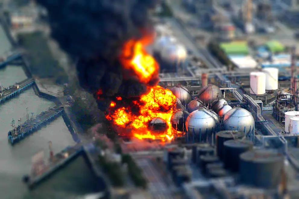
High return facilities
In energy production industries, like missile plant storage and nuclear plants, rescuers benefit from simultaneous and real-time multiple views of the intervention area(s) as well as geo - localization of each rescuer in the area, generating faster and more coordinated actions for effective disaster containment.
Miejsca takie są szczególnie narażone na ryzyko pożaru lub eksplozji ze względu na rodzaj prowadzonej działalności. Miejsca wysokiego ryzyka, takie jak zakłady naftowe lub produkcja ropy naftowej, wymagają szybkiej interwencji w celu ograniczenia potencjalnych zagrożeń, takich jak eksplozje i duże pożary.
Dzięki zastosowaniu iFalconHM w obszarach, w których znajdują się produkty o wysokiej wartości, możliwe jest uratowanie jak największej liczby cennych aktywów.
The system also enables real-time wireless video transmission, allowing incident commanders to assess the situation remotely. With live visual data, they can make faster and more informed decisions about firefighting strategies and personnel movements.
High-value facilities often have large and complex layouts, making navigation difficult, especially in emergencies. iFalconHM helps firefighters move efficiently through unfamiliar spaces, reducing the risk of getting lost or trapped.
Firefighter safety is another critical benefit. By providing real-time location awareness, iFalconHM helps teams stay connected and coordinated, ensuring safer exits, better rescue operations, and more effective tactical adjustments.
In facilities housing sensitive or high-value equipment, targeted firefighting is essential to minimize damage. Early detection of hot spots with thermal imaging allows teams to contain fires before they spread to critical infrastructure, protecting valuable assets and preventing catastrophic losses.
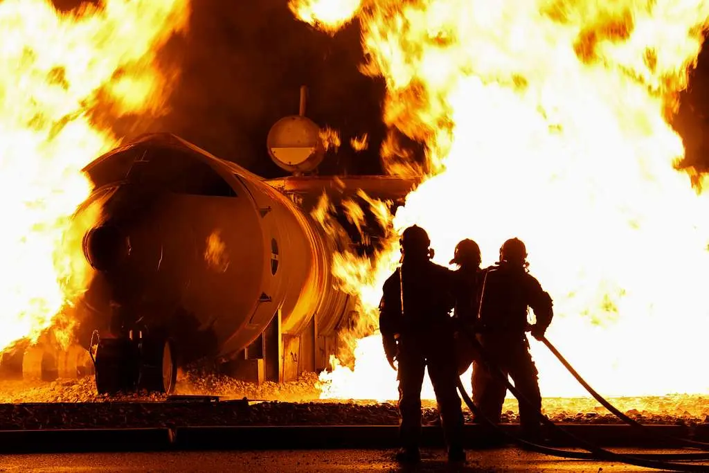
The iFalconHM system can provide crucial advantages during fires in high-return facilities such as data centers, manufacturing plants, and warehouses storing valuable goods.
Fires in these environments often produce thick smoke, making visibility almost zero. iFalconHM's thermal imaging allows firefighters to see through smoke, helping them locate fire sources, trapped individuals, and potential hazards. This improves situational awareness and speeds up rescue efforts.
Wide areas coordination
Emergency situations occurring over large areas are very difficult to manage. Coordinating operations is challenging when rescuers are far from each other and communication is compromised.
Pożary rozprzestrzeniają się bardzo szybko i wymagają szybkiego działania, aby zapobiec rozprzestrzenianiu się ognia. W przypadku pożaru lasu ratownicy korzystający z iFalconHM mogą korzystać z geolokalizacji i jednoczesnych widoków, które umożliwiają lepszą koordynację podczas interwencji, obejmując duże obszary, jednocześnie udostępniając ważne wideo i informacje.
The iFalconHM system is highly effective for wide-area coordination, where large spaces, multiple teams, and challenging conditions require seamless communication and visibility.
In large-scale incidents such as wildfires, industrial disasters, or search and rescue operations, maintaining situational awareness across vast areas is critical. iFalconHM’s thermal imaging allows teams to detect heat sources, locate individuals, and assess hazards even in smoke-filled or low-visibility conditions.
Effective coordination across wide areas depends on real-time information sharing. With wireless video transmission, command centers can monitor multiple teams simultaneously, ensuring a coordinated response. This allows for better resource allocation, reducing delays and improving overall efficiency.
Navigating open fields, industrial zones, or disaster-affected areas can be difficult, especially at night or in hazardous conditions. iFalconHM helps responders move efficiently, minimizing confusion and ensuring they reach critical locations as quickly as possible.
Team safety is a top priority when operating over large areas. Real-time tracking of personnel enables better coordination, ensuring no one gets lost or stranded in dangerous zones. This is especially important in fast-moving situations, such as wildfires or large-scale evacuations.
By using thermal imaging to detect hot spots, survivors, or potential hazards, iFalconHM helps teams focus their efforts where they are needed most. This targeted approach improves response times and maximizes efficiency, making it an invaluable tool for emergency management across wide areas.
Long Range Night Vision
Long Range Night Vision systems allow monitoring activities by ensuring leading-class long-range accuracy.
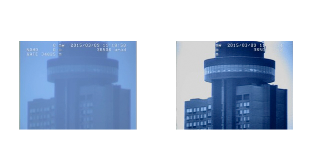
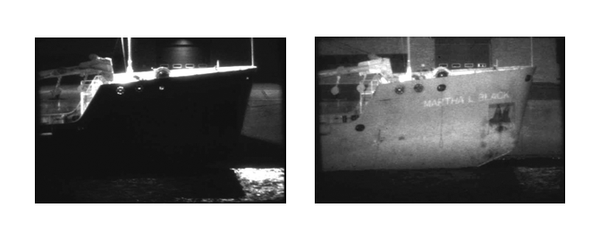
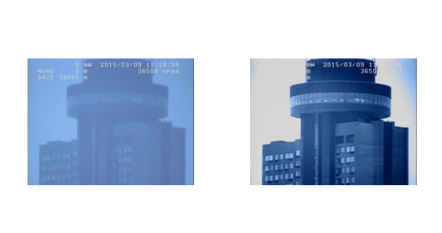
It's a breakthrough technology that provides superior identification and recognition capabilities compared to the best thermal imager. Long Range Night Vision produces remarkably detailed images over unprecedented distances.
Aby zebrać jak najwięcej informacji, system nadzoru nocnego musi być w stanie zapewnić obrazy wideo o wysokiej rozdzielczości w czasie rzeczywistym, zapewniające właściwości odblaskowe farby, materiałów i widzieć przez szkło w celu pełnej obserwacji. Co więcej, obrazy te muszą być reprezentatywną sygnaturą obserwowanego obiektu, najlepiej podobną do dziennej i bez względu na różne warunki temperaturowe.
Write something...
Coastal & Border control
Zagrożenia terrorystyczne i rosnące piractwo na trudnych do monitorowania szlakach wodnych zwiększają obawy o przetrwanie załogi i utratę ładunku. Doskonałym rozwiązaniem jest wdrożenie na pokładzie środków świadomości perymetrycznej, takich jak kamery noktowizyjne dalekiego zasięgu. Tym sposobem zagrożenia mogą być dostrzezone szybciej, nawet przy słabej widoczności.
Pozwala to na łatwiejszą kontrolę granic. Powodzie uchodźców, nielegalna imigracja i przemyt zachęcają rządy do wzmocnienia programów ochrony wybrzeży i granic. Wiele otwartych granic jest obecnie poddawanych przeglądowi. Niektóre kraje europejskie zaostrzają ochronę wzdłuż setek kilometrów granic i linii brzegowych, wdrażając systematyczne środki ściślejszego nadzoru.
Jest również wykorzystywany do nadzoru środowiskowego mającego na celu ograniczenie transportu nielegalnej ropy naftowej i materiałów toksycznych. Może być również wykorzystywany w programach antynarkotykowych, operacjach poszukiwawczych i ratowniczych oraz do identyfikacji nielegalnych połowów.
Vessel Traffic Services site protection
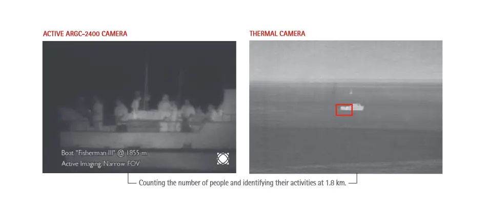
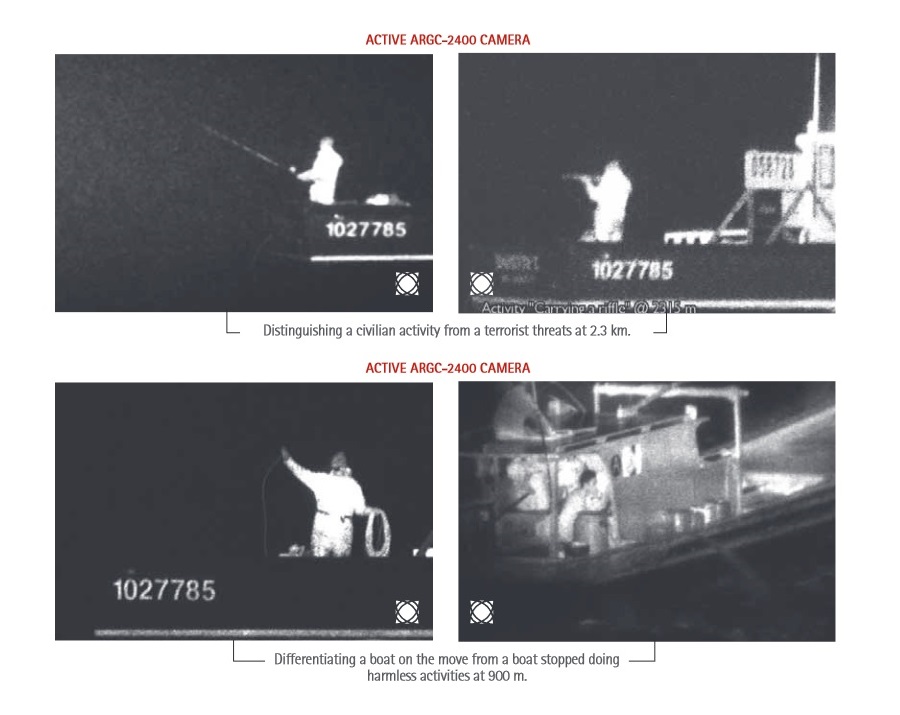
Zaawansowane kryteria bezpieczeństwa wymagają obecnie wizualnego potwierdzenia liczby osób zadeklarowanych przez załogę. Ważne jest również, aby zidentyfikować osoby na pokładzie i zobaczyć, co robią, a także czy personel na mostku wydaje się być pod przymusem. W dzisiejszych czasach rozwiązania do nadzoru muszą zapewniać możliwość sprawdzenia, czy ludzie lub określone towary są przenoszone między statkiem a małą jednostką, taką jak zodiak, lub czy towary są po prostu wyrzucane za burtę.
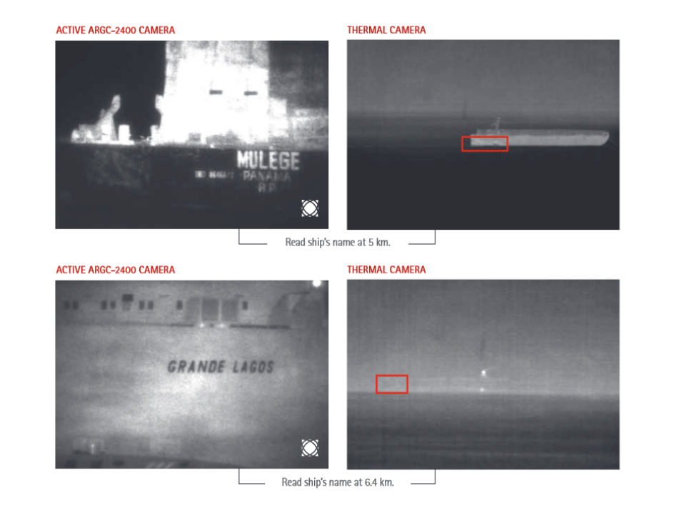
Służba kontroli ruchu statków to system monitorowania ruchu morskiego ustanowiony przez władze portowe, podobny do kontroli ruchu lotniczego dla samolotów. Jest to usługa wdrażana przez właściwy organ w celu poprawy bezpieczeństwa i wydajności ruchu statków oraz ochrony środowiska. Typowe systemy obsługi ruchu statków wykorzystują radar, telewizję przemysłową, radiotelefonię VHF i system automatycznej identyfikacji w celu śledzenia ruchu statków i zapewnienia bezpieczeństwa nawigacji na ograniczonym obszarze geograficznym.
Ochrona obiektów Służby Kontroli Ruchu
(Vessel Traffic Services)
Advanced security criteria now require a visual confirmation of the number of people declared by the crew. It is also important to identify people aboard and see what they are doing as well as if the personnel on the bridge seems under duress. In our day and age, surveillance solutions must provide the ability to see if people or certain merchandise are being transferred between a ship and a small craft such as a zodiac or if goods are simply thrown overboard.
Kontrola wybrzeża i granic
Zagrożenia terrorystyczne i rosnące piractwo na trudnych do monitorowania szlakach wodnych zwiększają obawy o przetrwanie załogi i utratę ładunku. Doskonałym rozwiązaniem jest wdrożenie na pokładzie środków świadomości perymetrycznej, takich jak kamery noktowizyjne dalekiego zasięgu. Tym sposobem zagrożenia mogą być dostrzezone szybciej, nawet przy słabej widoczności.
Pozwala to na łatwiejszą kontrolę granic. Zalew uchodźców, nielegalna imigracja i przemyt zachęcają rządy do wzmocnienia programów ochrony wybrzeży i granic. Wiele otwartych granic jest obecnie poddawanych kontroli. Niektóre kraje europejskie zaostrzają ochronę wzdłuż setek kilometrów granic i linii brzegowych, wdrażając systematyczne środki ściślejszego nadzoru.
Jest również wykorzystywany do nadzoru środowiskowego mającego na celu ograniczenie transportu nielegalnej ropy naftowej i materiałów toksycznych. Może być również wykorzystywany w programach antynarkotykowych, operacjach poszukiwawczych i ratowniczych oraz do wykrywania nielegalnych połowów.
Noktowizor dalekiego zasięgu
Systemy noktowizyjne dalekiego zasięgu umożliwiają monitorowanie działań, zapewniając wiodącą w swojej klasie dokładność dalekiego zasięgu.
Jest to przełomowa technologia, która zapewnia doskonałe możliwości identyfikacji i rozpoznawania w porównaniu z najlepszą kamerą termowizyjną. Noktowizor dalekiego zasięgu zapewnia niezwykle szczegółowe obrazy na niespotykanych dotąd odległościach.
Aby zebrać jak najwięcej informacji, system nadzoru nocnego musi być w stanie zapewnić obrazy wideo o wysokiej rozdzielczości w czasie rzeczywistym, zapewniające właściwości odblaskowe farby, materiałów i najlepiej przezroczyste szkło w celu pełnej obserwacji. Co więcej, obrazy te muszą być reprezentatywną sygnaturą obserwowanego obiektu, najlepiej podobną do dziennej i bez wpływu różnych warunków temperaturowych.
System Monitorowania Ruchu to system monitorowania ruchu morskiego ustanowiony przez władze portowe, podobny do kontroli ruchu lotniczego dla samolotów. Jest to usługa wdrażana przez właściwy organ w celu poprawy bezpieczeństwa i wydajności ruchu statków oraz ochrony środowiska. Typowe systemy obsługi ruchu statków wykorzystują radar, telewizję przemysłową, radiotelefonię VHF i system automatycznej identyfikacji w celu śledzenia ruchu statków i zapewnienia bezpieczeństwa nawigacji na ograniczonym obszarze geograficznym.